Abyssal Topography
Category
Design
Year
2023-1
Software and Tools
MatLab, CNC Router (Computer Numerical Control).
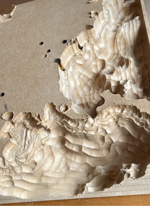
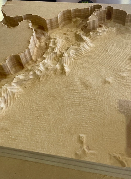
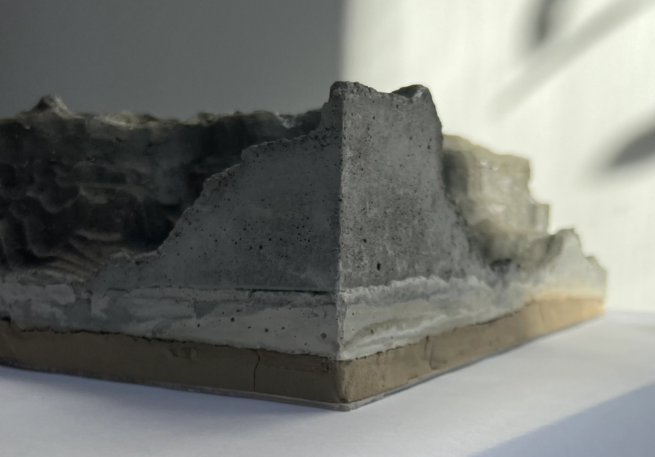
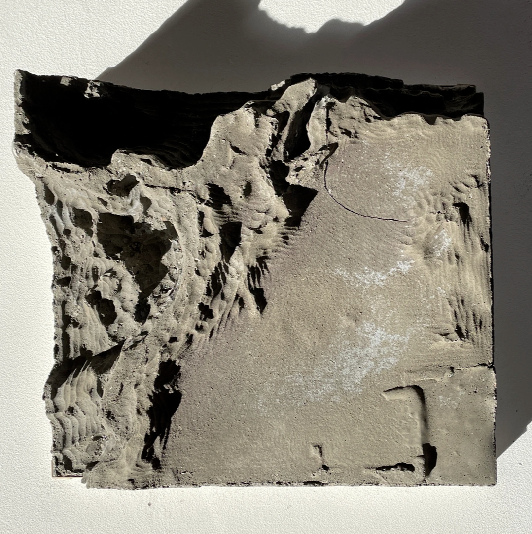
Data sculpture that gathers altitude and depth
Saying that Colombia has the shape of a diamond is as simplistic as thinking the Earth is flat. Georeferencing technologies and topographic data make it possible to recreate the Earth’s surface with such precision that even the notion of perfect roundness is challenged. Abyssal Topography is a data sculpture that gathers altitude and depth values corresponding to Colombia and its surroundings, constructing a scaled representation of its complete morphology.
Colombia does not end at the coastline: it continues beneath the sea, where underwater trenches and geographic features expand and transform its shape. Referring simply to “sea level” is misleading, as the ocean is a territory of multiple depths, the understanding of which has long been a major scientific challenge. Today, as the crucial role of marine ecosystems in sustaining life becomes increasingly recognized, this invisible dimension of the territory gains renewed significance—acknowledging its diversity and adaptability as part of the planet’s evolutionary future.


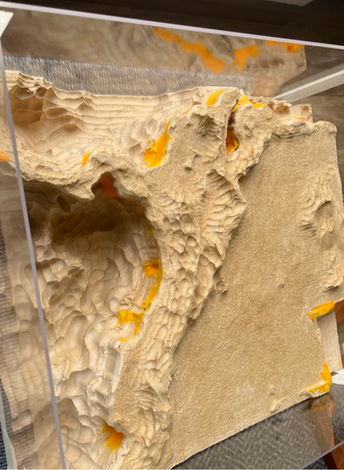
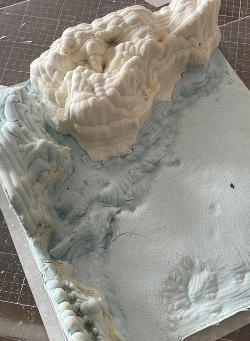
Using topographic data and delimiting the area of interest with coordinates (13° N, -84° W to 5° S, -64° W), the surface of Colombian territory was digitally modeled. This topography served as the basis for carving a solid MDF block using CNC (Computer Numerical Control) technology. The block was then sanded and manually refined to create a negative mold in alginate. This mold enabled the final casting of the piece in concrete, translating the geographic information from the digital model into a physical object.